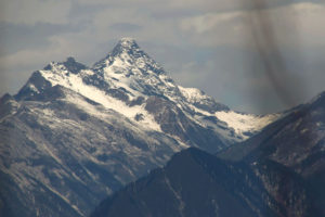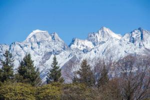
Qionglaishan Range
Qionglaishan Range
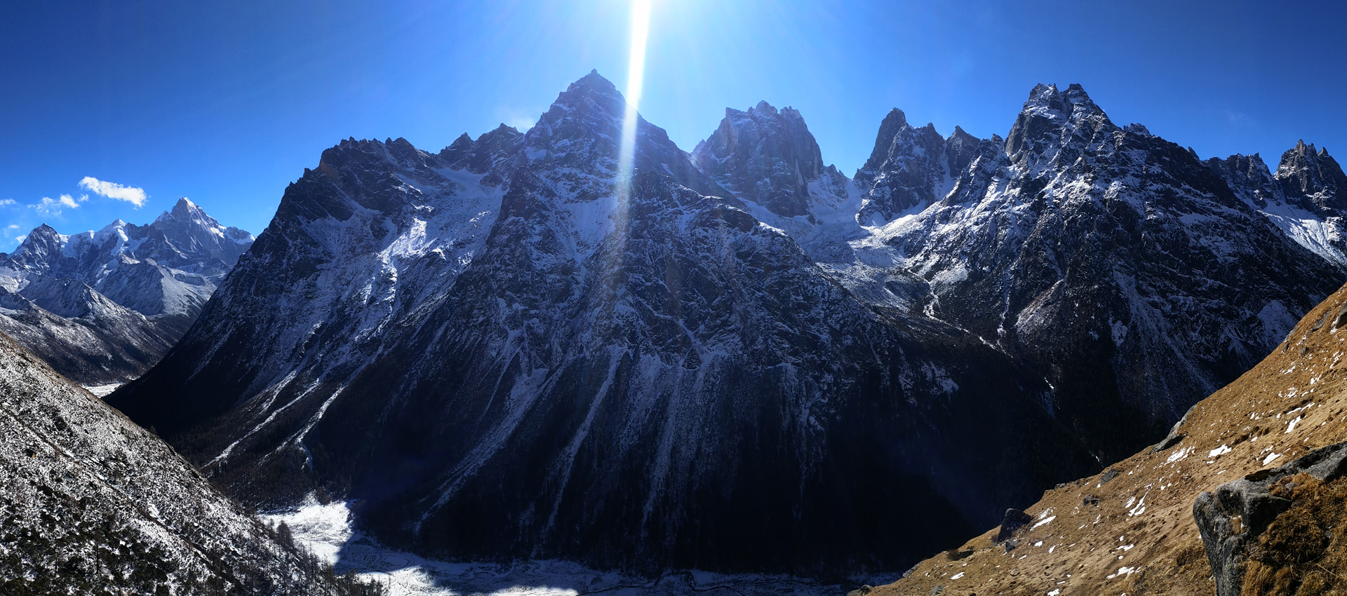
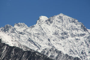
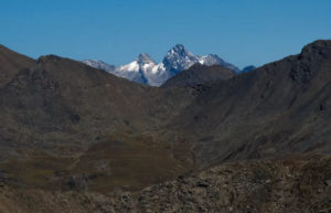
Siguniang Massif
Introduction
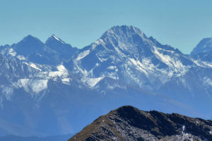
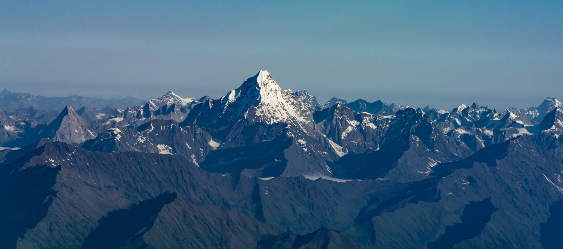
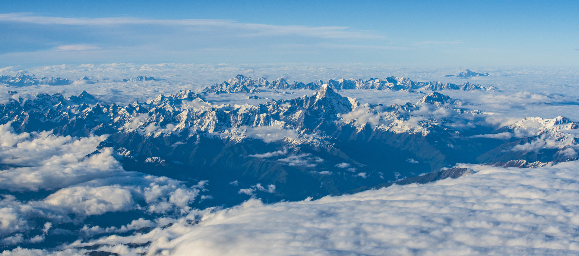
Qionglai Shan Range is 250km in length and lies from north to south, separating Minjiang River and Dadu River in northwest of Chengdu. The highest mountain in this range is Yaomei Peak in Mount Siguniang, 6225 meters above sea level. Most of the range is in Ngawa Tibetan and Qiang Autonomous Prefecture. South of the range is in Ya’an with its name often known as Jiajin Mountains. Eastern face of the range is home to giant pandas. Qionglai Shan Range is also a geological line between Sichuan Basin and Tibetan Plateau. Qionglai Shan Range is considered the eastern border of Hengduan Mountains. The other mountains in Qionglai Shan Range will also include Mt. Xuelongbao, San Ao Mountains, Mount Daxuetang, Jiajin Mountains, Bawang Mountains, etc.
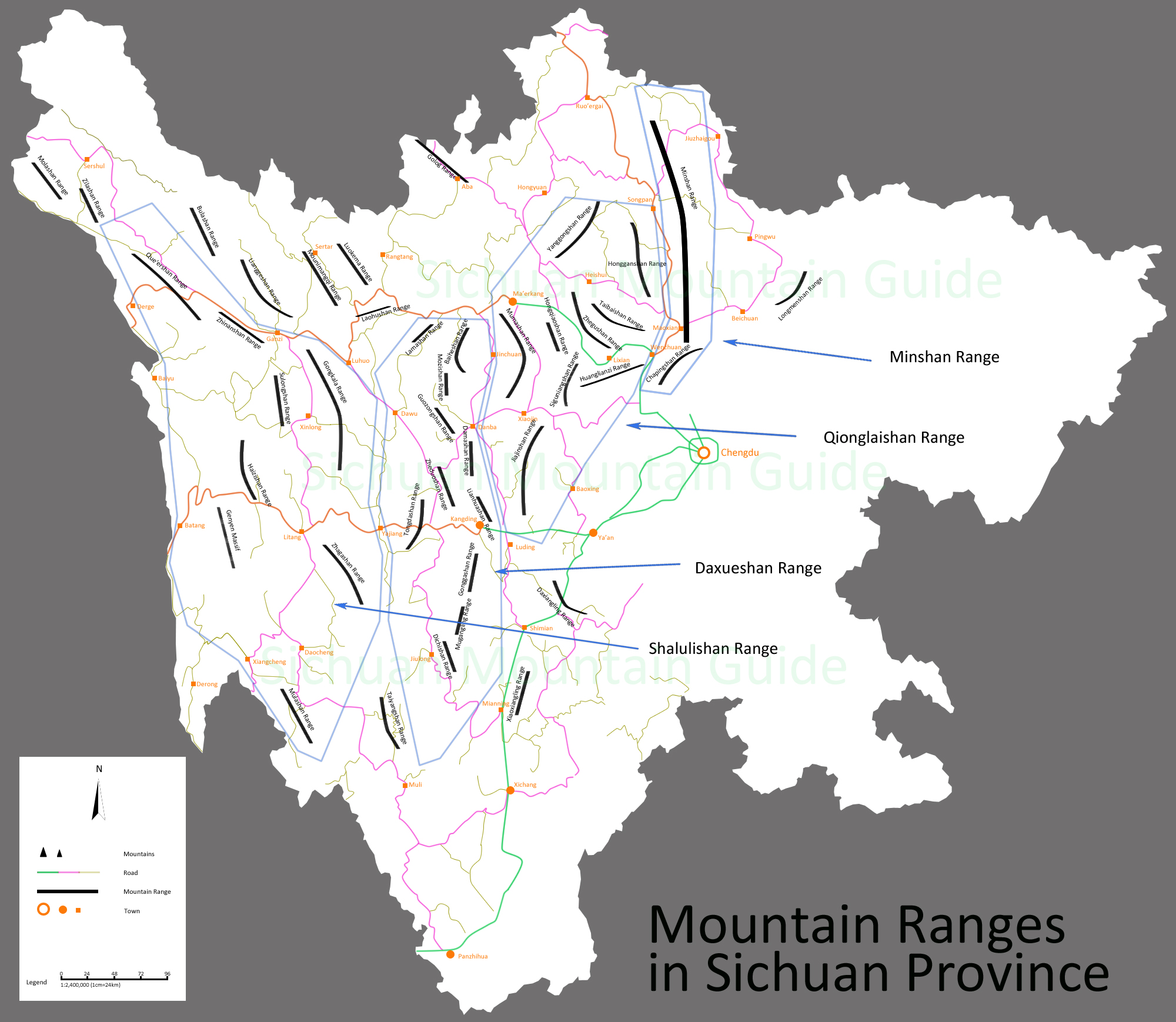
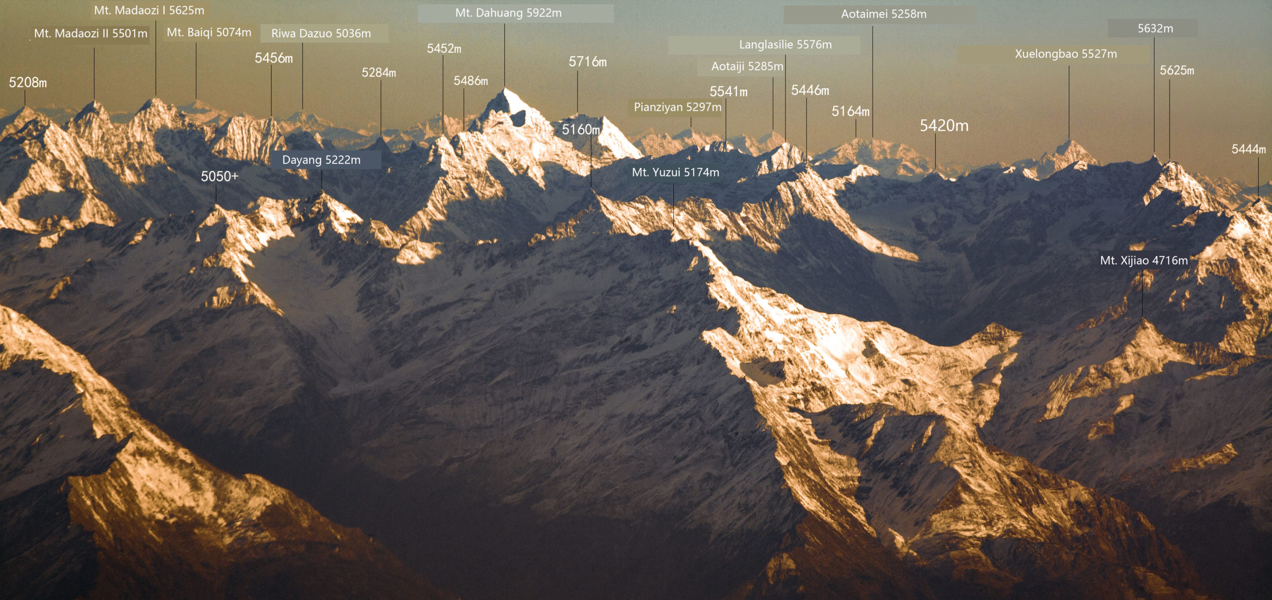
Mountains between Minjiang River and Dadu River is Qinglaishan Range. It has subranges including Honggang Mountains, Yanggong Mountains (highest peak Mt. Kangtso 5273m), Taibai Mountains (highest peak Mt. Wushaolue 5230m), Zhegu Mountains (highest peak Mt. Xuelongbao at 5527m), Daxuetang Mountains (highest point at 5364m), Jiajin Massif (highest mountain at 5734m), and the central part of Qionglaishan Range where locates the high mountains including Mt. Yaomei (6225m), Mt. Dahuang (5922m), Mt. Abi (5694m), Mt. Se’erdengpu (5592m), Mt. Bawang (5551m), Mt. Yangmantai (5666m).
Climbing Season
East of the range is humid and west is drier. Monsoon season is from April to October.
Mountains
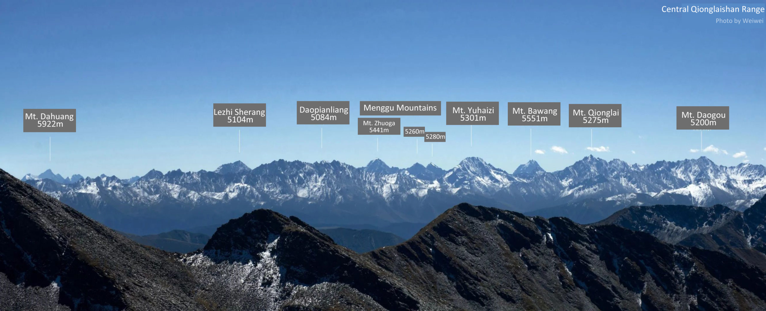
Hongqiao Mountains is a cluster of mountains located in the central part of Qionglaishan Range. It has several mountains that are over 5000 meters with the highest mountain Mt. Bawang at 5551 meters. This cluster of mountains is located between Fubian River (West) and Zagunao River (East) and Somo River (North). The other mountains include Mt. Menggu at 5441 meters, Mt. Sibogo at 5301 meters.
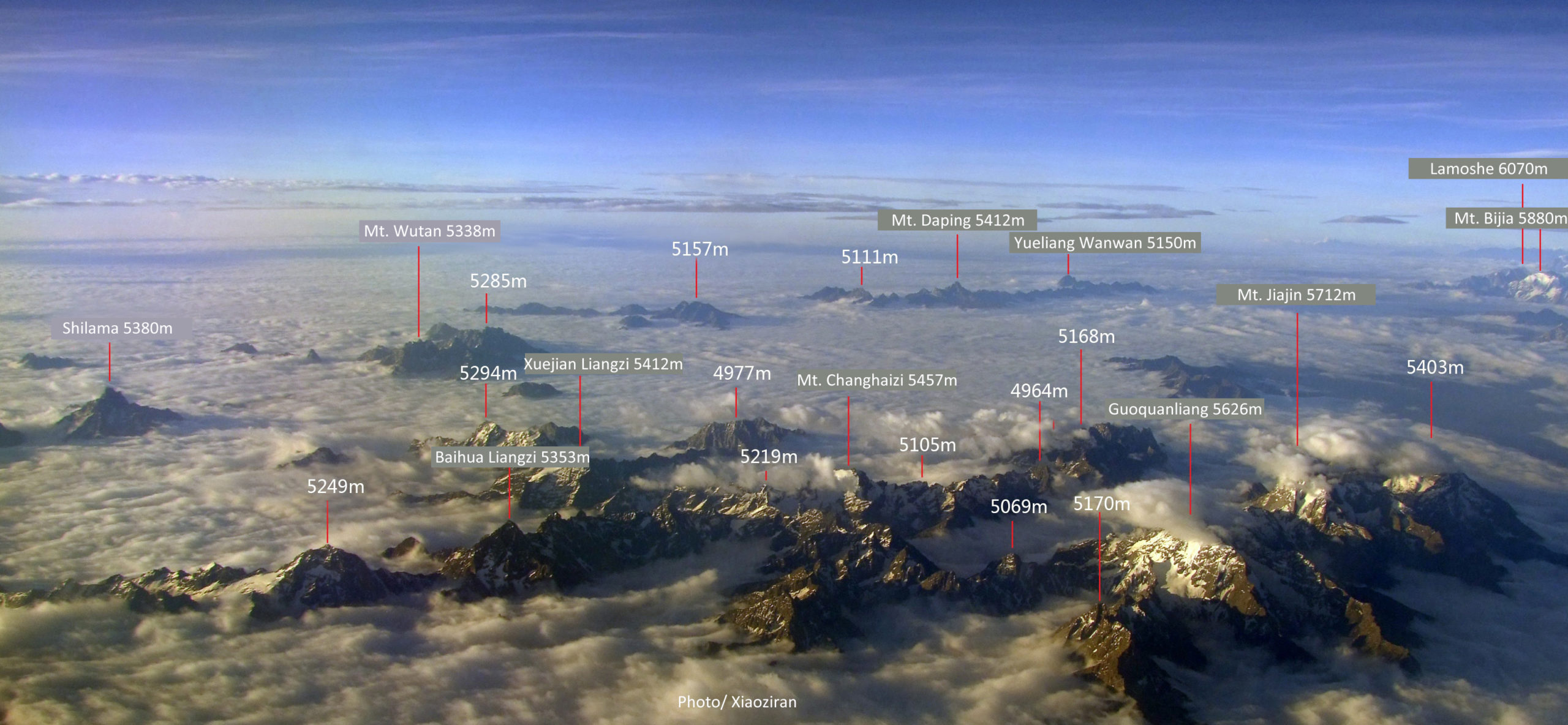
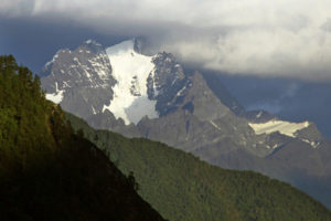
Jiajin Mountain Massif is part of Qionglaishan Range. It is located at the southern part of Qionglaishan Mountain Range. Because it covers a large area, some resources listed it as a seperate range. The Jiajin Massif is between Dadu River and Qingyi River. North of Jiajin Massif is south to Barkam town and south part of Jiajin is by Dadu River near Luding town. With its west being Daxueshan Range and its east the panda sanctuary, Jiajin Mountains are the least explored areas with prominent and climable mountains in China. Though the elevations are below 6000 meters but above 5000 meters mountains look really interesting.
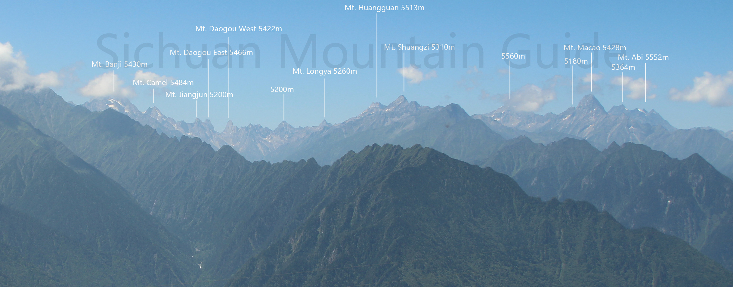
Zhegu Mountains is located in the north part of Qionglaishan Range in Lixian County. Its east is Mengdun Valley and its west Hongqiao Mountains in the central part of Qionglaishan Range. North of Zhegu Mountains including Sanao Mountains are located in Heishui County. Its northern part connects the Dabai Mountains. Mengdun Valley seperates Dabai Mountains and Zhegu Mountains.
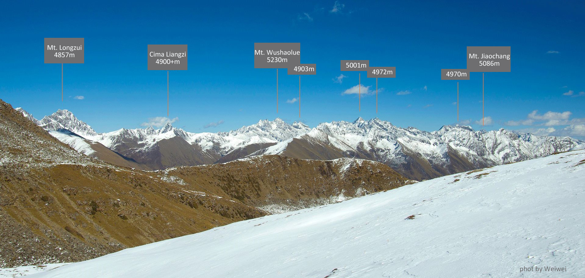
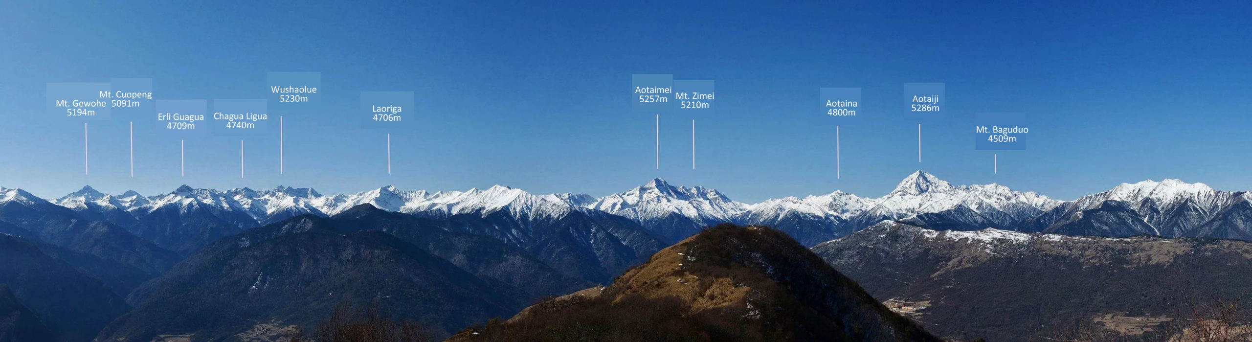
Dabai Mountains is a subrange located in the northern part of Qionglaishan Range. Its north is Heishui County and its south is Lixian County. East of the mountains is Minjiang River. It joins Zhegu Mountains by its west. The highest peak is Mt. Wushaolue at 5230 meters.
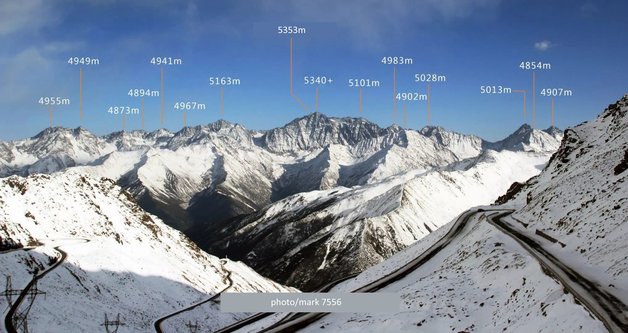
North part of Qionglaishan Range is located in the north part of Heishui County. It is called Yanggong Mountains where it borders Hongyuan County by its north. There are some 5000+ mountains meters people never heard of. It borders Songpan County by its northeast. Yanggang Mountains is located between Heishui River and Naxi Valley, connecting Zhegu Mountains by its south with a small range called Yaksha. There are no recorded climbs in this part of Qionglaishan Range.
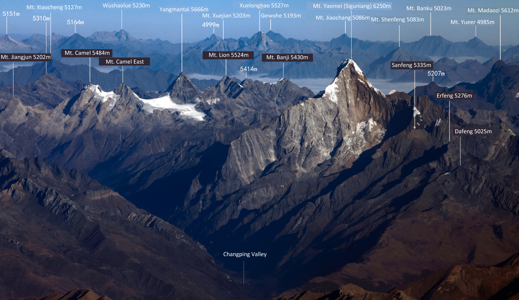
Mount Siguniang Range is located 200km west to the capital city of Chengdu in Xiaojin of Aba Tibetan and Qiang Autonomous Prefecture. The east of the mountains lie habitats of pandas. North to south of this massif is around 40km and west to east is also around 40km. It is home to over 40 peaks over 5000 meters with the highest one Yaomei Peak soars to 6250 meters above seas level.
Daxuetang Mountains is located by the southeast of Qionglaishan Range. It is the closest 5000-er to Chengdu and the border mountain between Chengdu, Ya’an and Aba, making it the highest point of Chengdu. The highest peak of Daxuetang was recorded as 5364 meters above sea level. Newer research shows it’s actually lower than this.
To climb in Qionglaishan, places include Rilong (Siguniang) and Lixian (Siguniang North and Central Qionglaishan Range) are the essential locations to be checking.
List Mountains in Qionglaishan Range