Siguniang Shan Range
Mt. Siguniang Massif
Siguniang Mountain Range
Siguniangshan Range
Introduction and Location
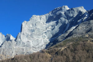
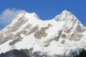
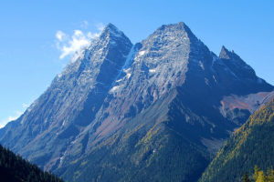
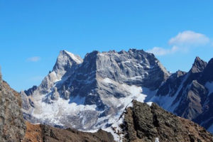
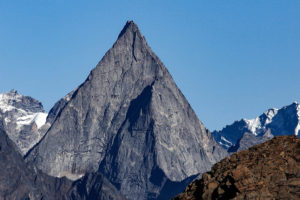
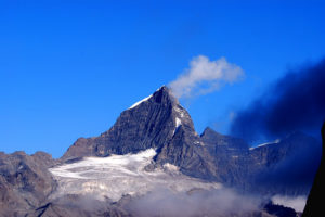
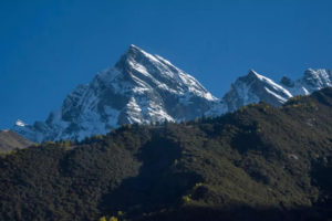
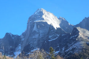
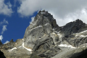
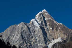
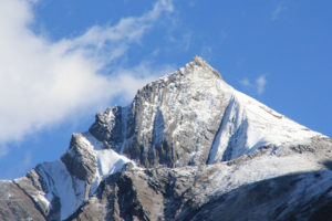
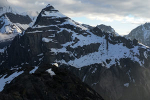
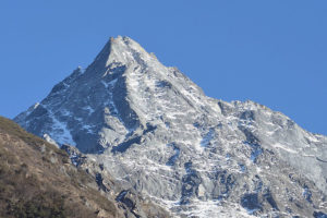
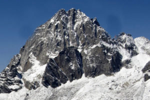
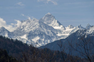
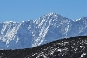
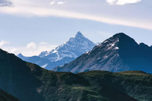
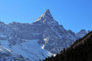
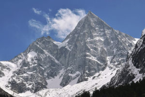
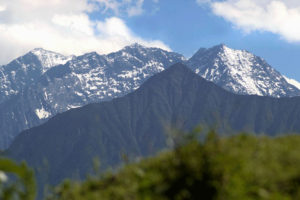
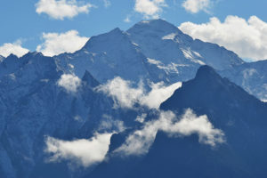
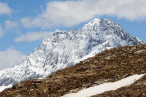
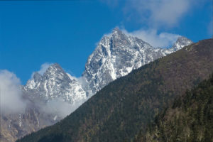
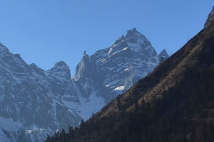
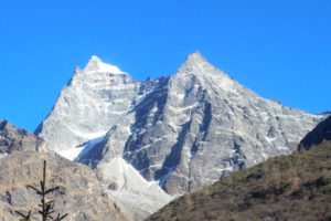
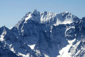
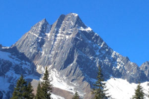
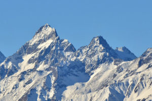
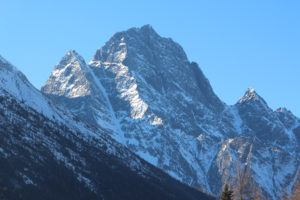
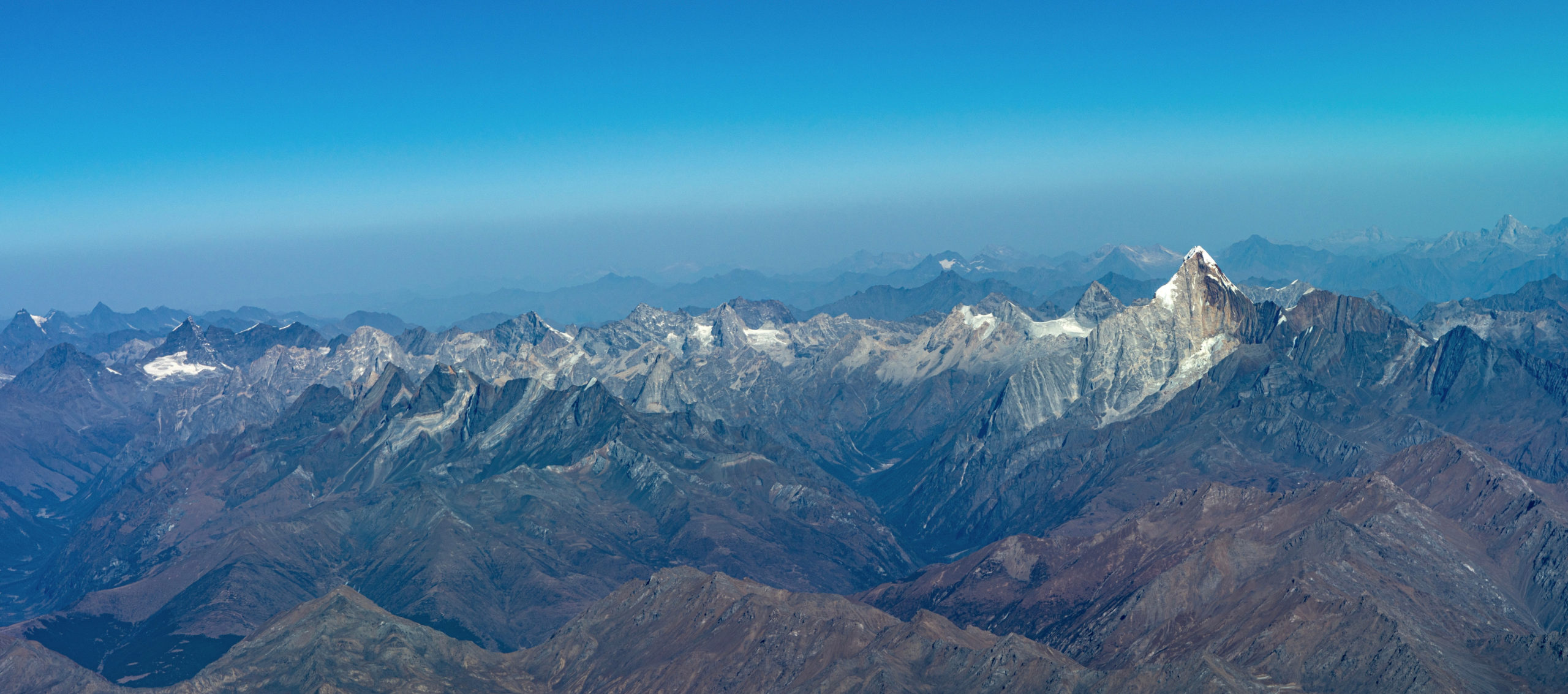
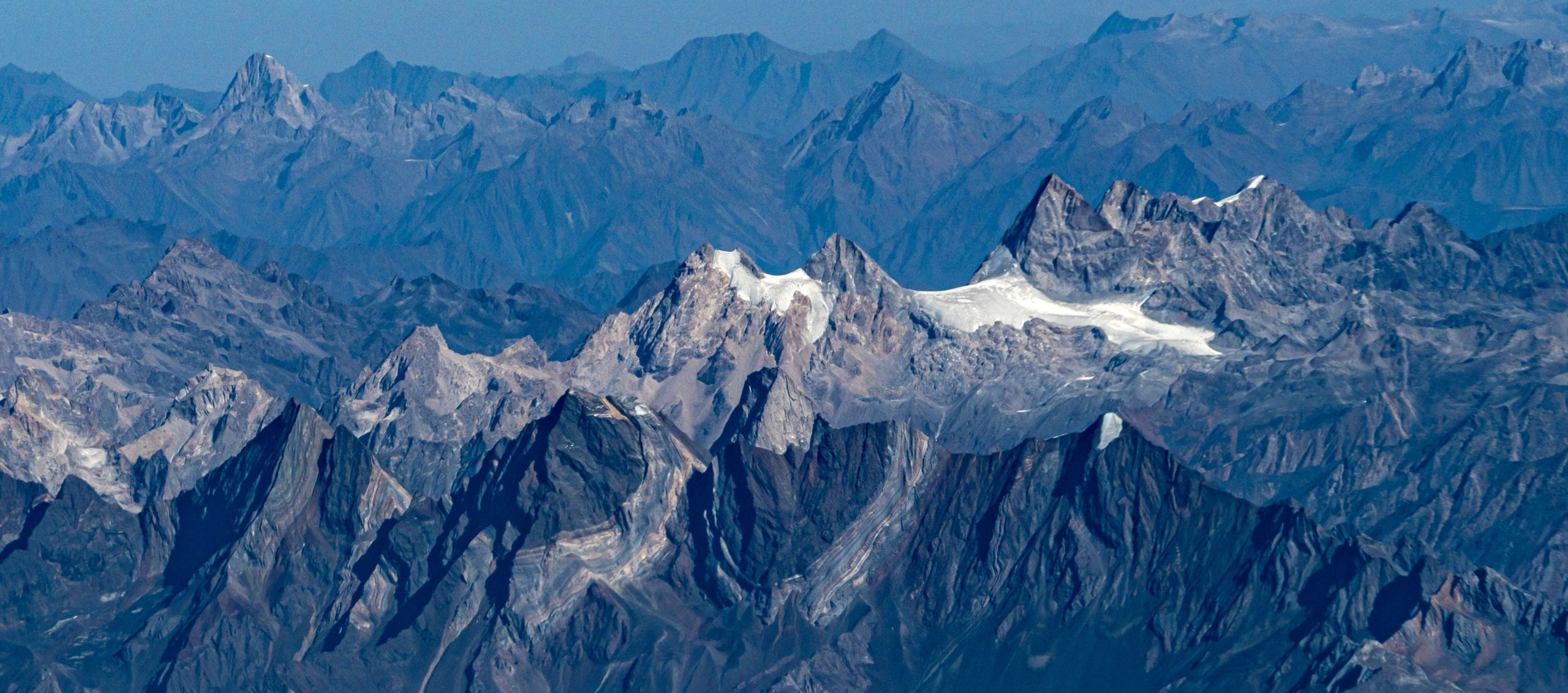
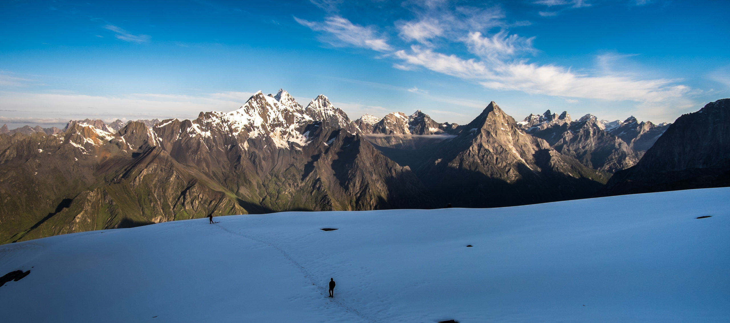
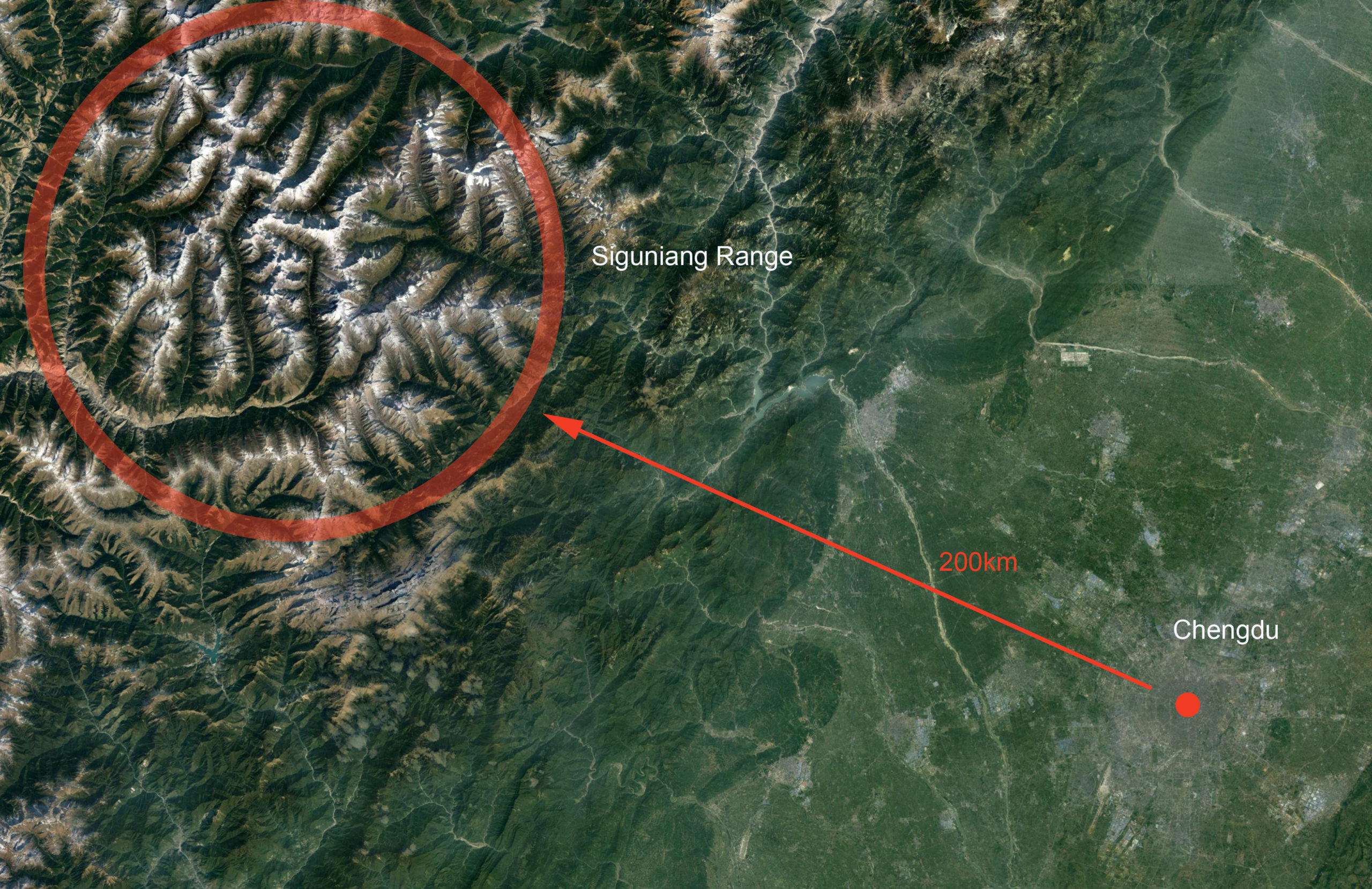
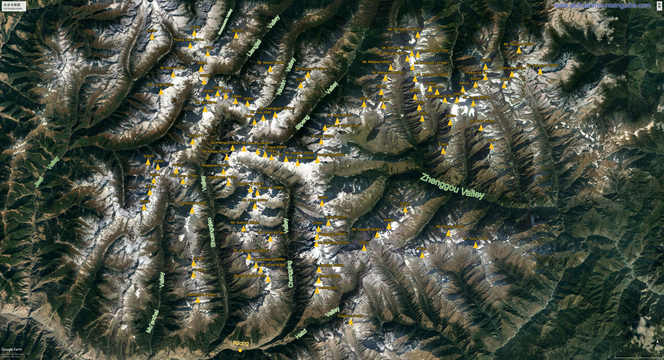
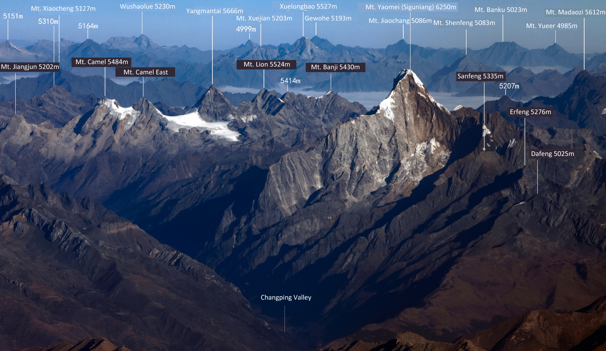
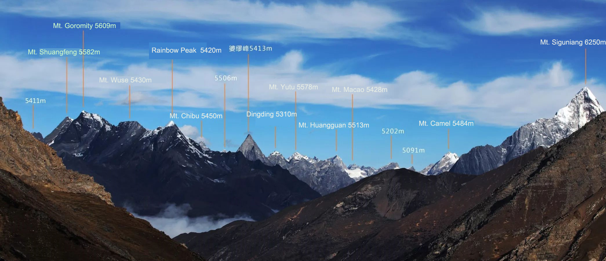
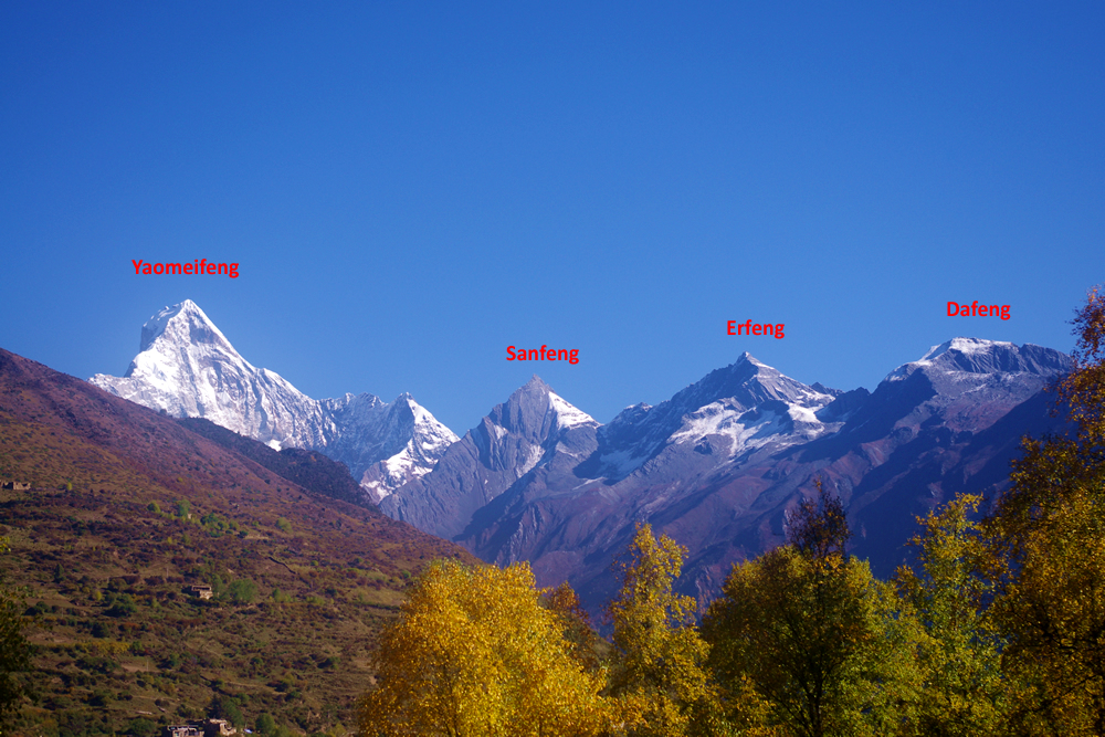
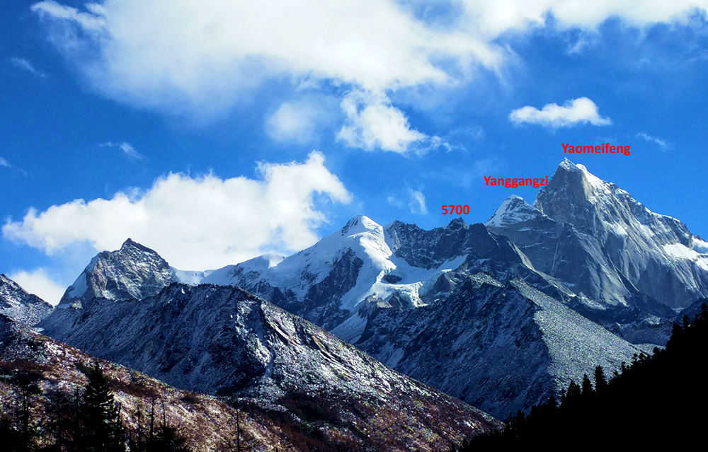
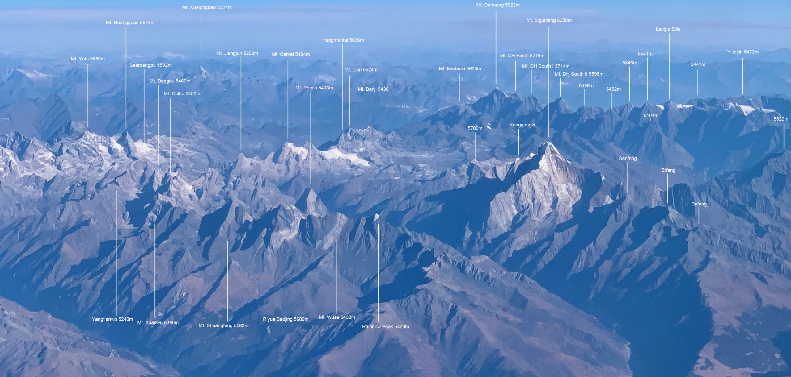
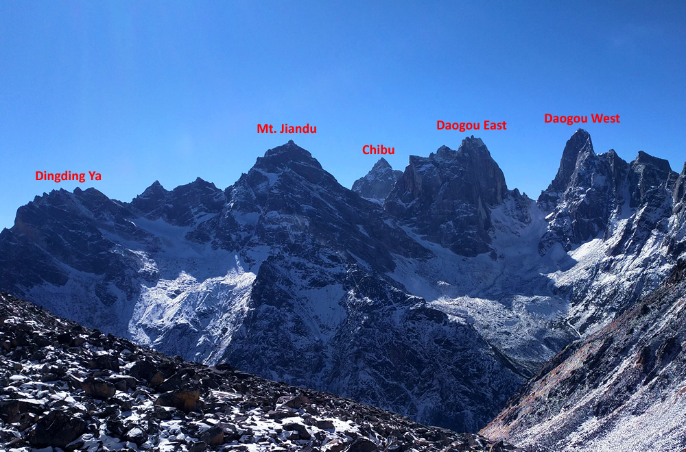
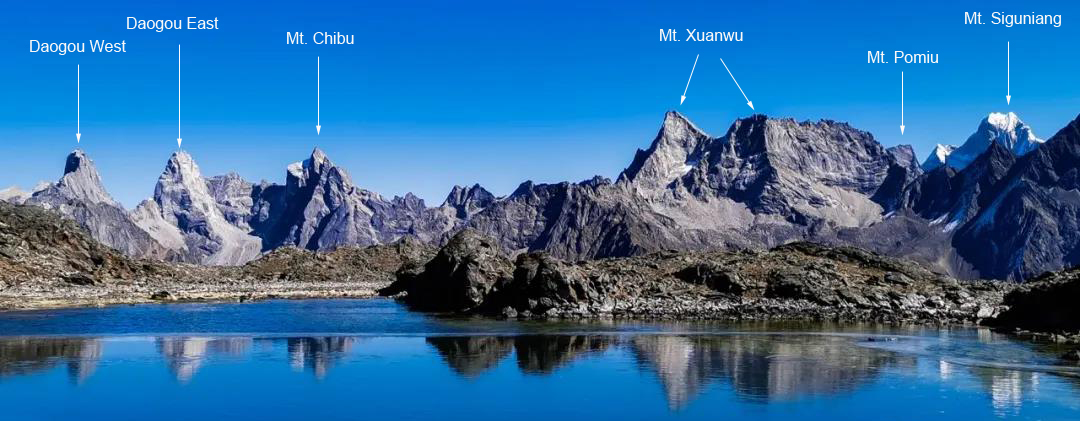
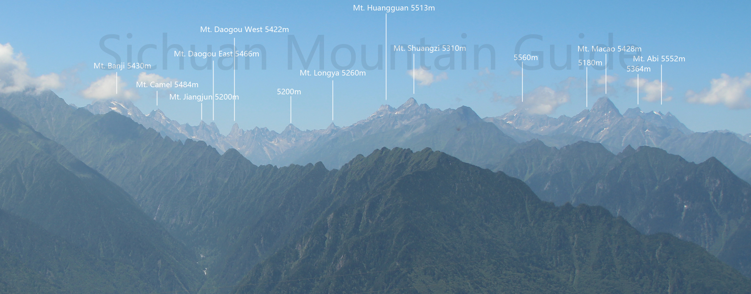
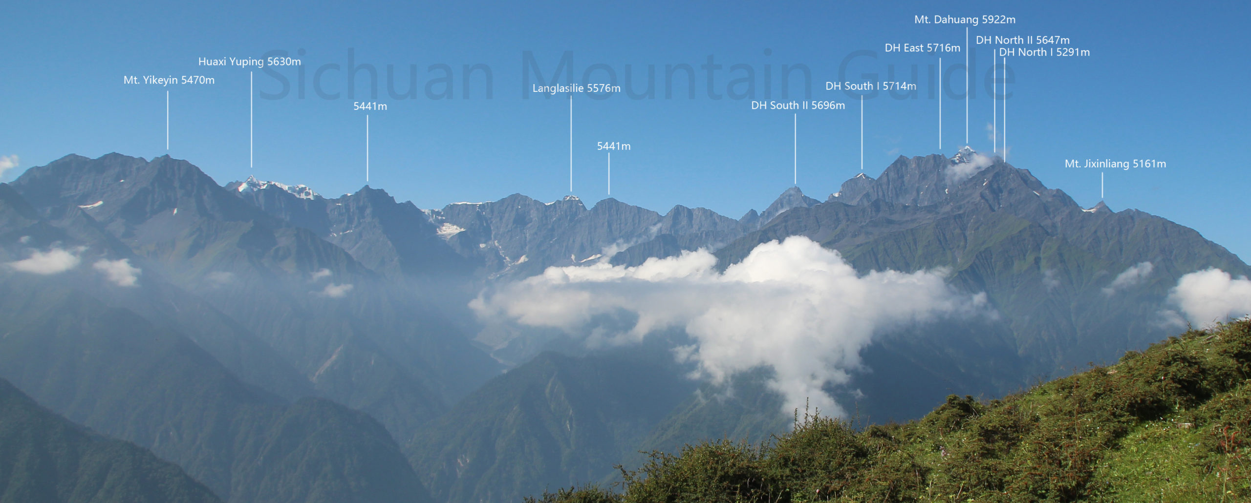
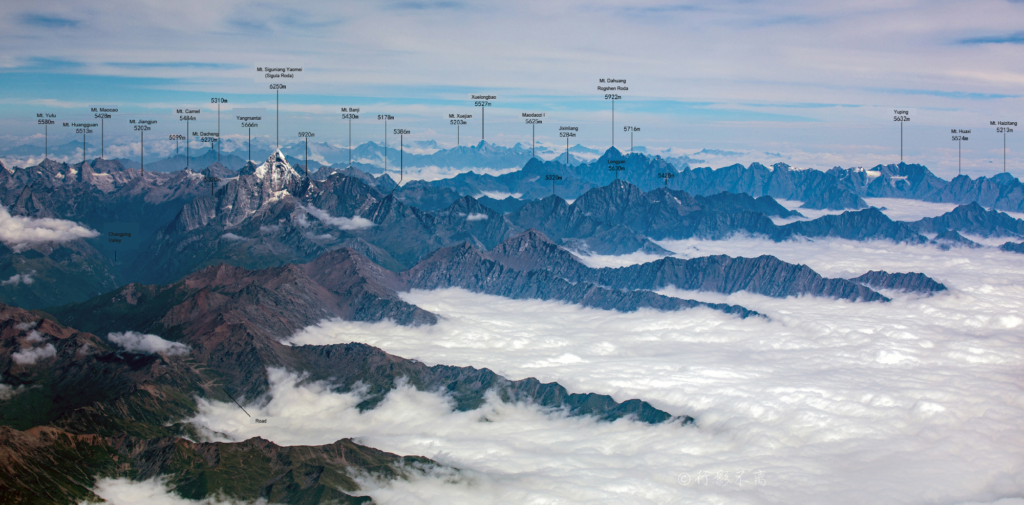
Mount Siguniang Range is located 200km west to the capital city of Chengdu in Xiaojin of Aba Tibetan and Qiang Autonomous Prefecture. The east of the mountains lie habitats of pandas. North to south of this massif is around 40km and west to east is also around 40km. It is home to over 40 peaks over 5000 meters with the highest one Yaomei Peak soars to 6250 meters above seas level. Mount Siguniang is not only a popular travel destination in China but also a favored place for mountaineering. Siguninang mean four sisters, the name was given from the lined four peaks from Yaomei Feng to Da Feng at the south of Changping Valley. Among these mountains there are also Mount Daogou (5465m), Pomiu (Celestial Peak, Jianzi Shan, 5413m), Mount Wuse (Mt. Five Colors, 5500m), Mt. Lieren (Mt. Hunter, 5360m), Mount Laoying (Mt. Eagle, 5428m), Mount Niuxin (Mt. Ox Heart, 4942m), Mt. Yangmantai (5666m), Mt. Seerdengpu (5182m). Many of the mountains in Mount Siguniang massif have been climbed yet some are still not summitted.
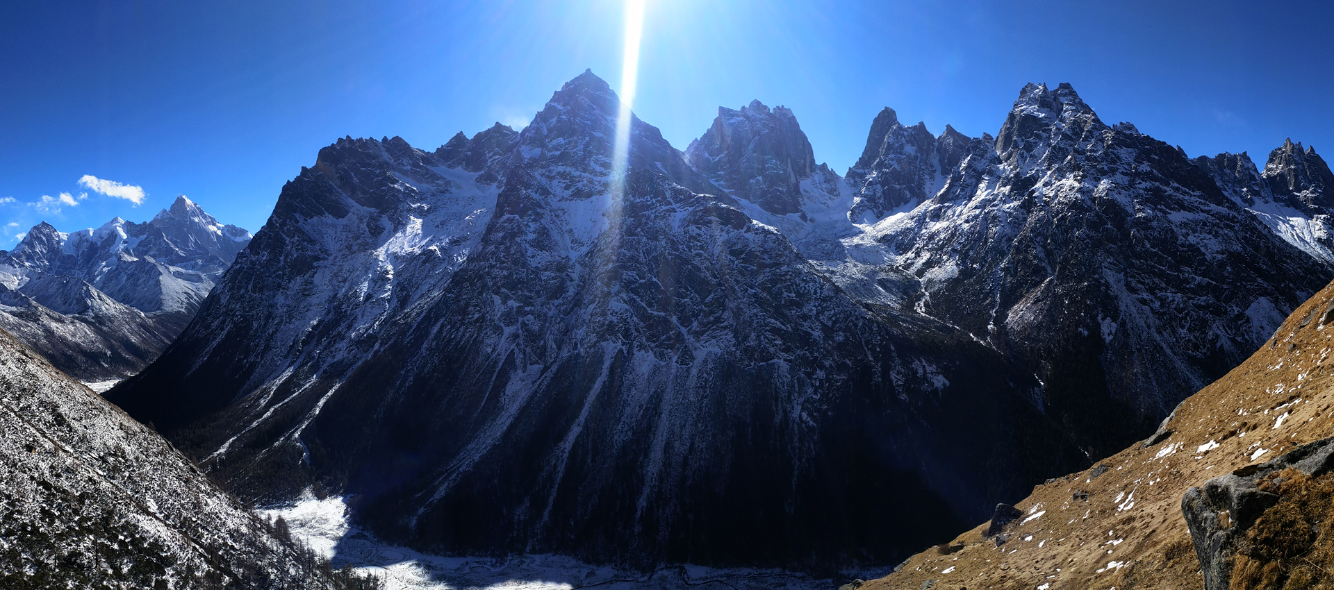
Included here are mountains in Shuangqiao Valley, Cahngping Valley, Haizi Valley, Zhenggou Valley, Bipeng Valley that are in the central part of Siguniang Massif. The mountains north to Siguniang Park are in general also part of Siguniang Massif. The valeys in in the north include Guanmenka Valley, Liangtai Valley, Niuxin Valley and Bipeng Valley. The river that connects these valleys is called Suolo River.
How to get there
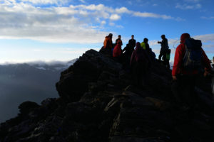
Mount Siguniang is not considered a remote place. The town of Rilong is close to Chengdu. By driving it takes about 4-5 hours with the new road completed in 2016. Rilong can be used as a place to buy basic food. There are plenty of shops and restaurants available. Also there are gears shops as well. Rilong is one of the places in China that have climbers coming throughout the year. Mount Siguniang is used as a training base of mountaineering in China.
From the town of Rilong, a simple walk or short drive shall take you to the entrances of the valleys at south of Mount Siguniang Range. However is enter from the north, you will have to ride to a town called Lixian in the north. The drive to Lixian is around 4 hours from Chengdu. Lixian is a bigger town than Rilong but does not have gear shops as many as in Rilong. To enter from the north valleys to Mount Siguniang Range you need to use a car ride for another couple of hours from Lixian.
Climbing Season
Mt. Siguniang Range is between Subtropical Monsoon Climate zone and Continental Mountain Climate zone. It has cold winter and cool summer. Annual rainfall is around 1200mm. The monsoon season is from May to September. From November to the next February is the dry season. Snow and rain come usually by March. A lot of former attempts/ expeditions were done in different time of the year there from April to October. August in a dry year does not rain too much and it is one of the warmest seasons. Ice-climbing is normally conducted in winter times here.
Mountains and Peaks
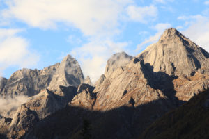
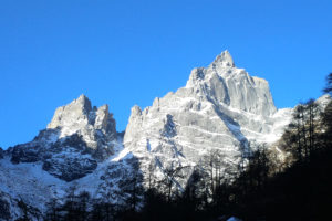
Except Yaomei Feng which is 6250 meters high, there are over 40 peaks that are over 5000 meters. Basically the ranges lie north to south and connect in the middle. South of the valleys are the entrances of the parks. The town of the Siguniang Mountains is called Rilong and now they have a new name: Mount Siguniang Town. Rilong is a small tourist town where accommodations and restaurants are available. Rilong is at the elevation between 2900m and 3100m. Hiking travel is also very popular here. Seasonal trekkings to summits of Da Feng, Er Feng are available. Lots of people come here to do climbing every year. Mountains at Mount Siguniang include Potala Peak (5240m), Banji Feng (5430m), Mount Daogou (5433m), Dahuang Feng (5922m), Huangguan Feng (5513m), Jiujia Feng (5130m), Mount Jianzi (Pomiu, 5472m), Longji Feng (5523m), Luotuo Feng (5484m), Mt. Qugadeng (4989m), San Feng (5355m), Xuanwu Feng (5390m), Yinggezui Feng (5180m), Mount Yangmantai (5666m), Mount Yuewanding (5100m).
There are four major valleys in the south and other shorter valleys from the north. At the south from east to west lie Haizi Valley, Changping Valley and Chuangqiao Valley, Muerzhai Valley. Good walking trails in Changping Valley are at the bottom of the valley, elevation between 3500m to 4000m. Trail at the bottom of Haizi Valley is at elevation between 3600m and 4000m. Elevation of trails in Shuangqiao Valley is below 4000m. Elevation of trails in Muerzhai Valley is between 3600m and 4200m.
By the north of Siguniang Massif there are also many valleys including the tourist park Bipeng Valley and the Liangtai Valleys to its west. Siguniang Massif ranges not only by the national parks by the south but also extends to its east by the panda sanctuary to Wenchuan Xian.
Rilong is the place for trips to Siguniang Massif.
List of Mountains in Siguniang