Zhegu Mountains is located in the north part of Qionglaishan Range in Lixian County. Its east is Mengdun Valley and its west Hongqiao Mountains in the central part of Qionglaishan Range. North of Zhegu Mountains including Sanao Mountains are located in Heishui County. Its northern part connects the Dabai Mountains. Mengdun Valley seperates Dabai Mountains and Zhegu Mountains.
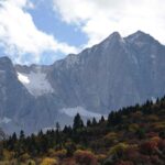
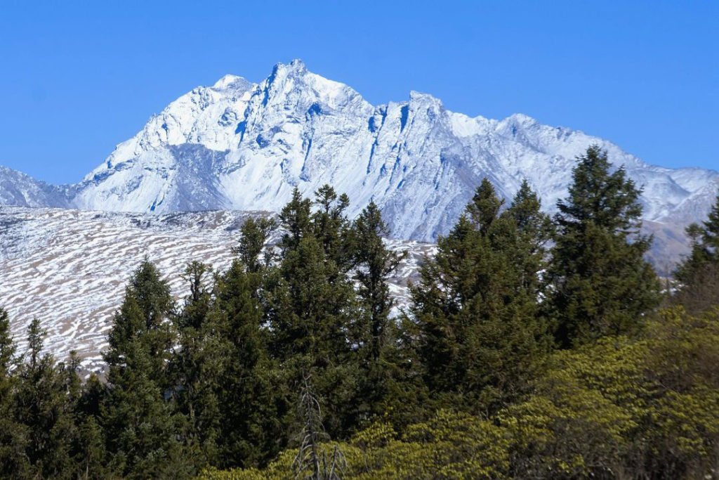
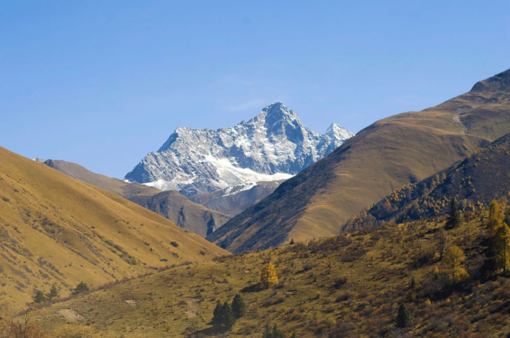
The Highest mountain of this part of Qionglai Range is Mt. Xuelongbao at 5527 meters. There are over a dozen mountains that are above 5000 meters.
Mountains
Mt. Xuelongbao
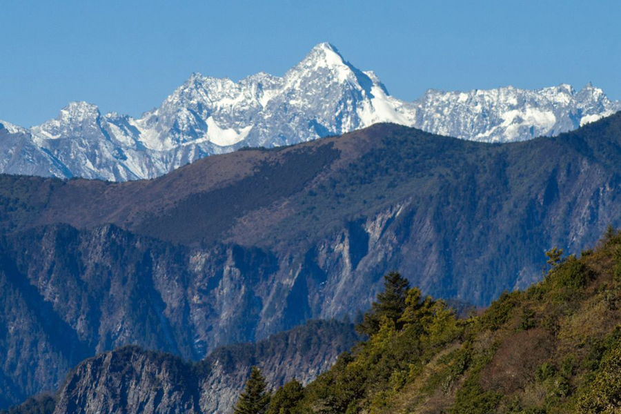
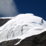
Elevation of Mt. Xuelongbao is 5527 meters. It’s the second highest mountain of Aba. There has been several summits to this mountain. Former climbs were conducted from late spring to end autumn.
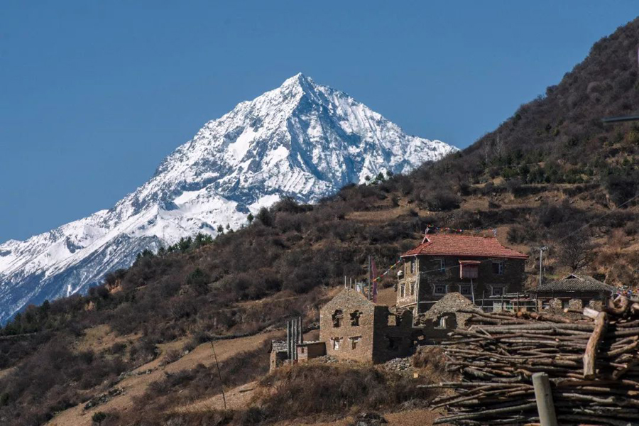
Mt. Xuelongbao is called Mado Shigu by local Tibetans. It is located in Shangmeng Village, Lixian County of Aba. According to former climbers this mountain is a medium mountain to climb. Most former climbs all started from Laojun Valley via Shangmeng and climbed the east side.
On the north ridge of Mt. Xuelongbao there are two side peaks that are 5154 meters and 4919 meters Mt. Nian’ermi. On the south ridge of Mt. Xuelongbao there ridgeline is high where a prominent peak is 5079 meters.
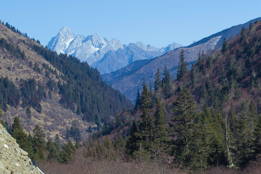
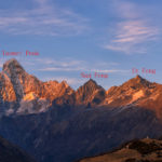
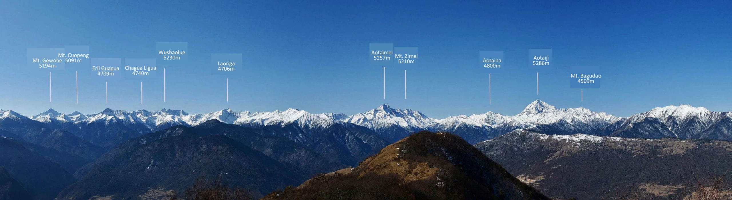
Mt. Zulang is 5342 meters above sea level. Mt. Zulang means Slope of Lake. It is a mountain with glacier by its south wall. South to this peak there is a side peak that is around 5100 meters.
Mt. Pianziyan is in the cluster of mountains near Zulang. The other mountains that are with similar heigh locates by the end of the valley and not often seen. South to Mt. Pianziyan there is a 5221-m mountain and east to Mt. Pianziyan there is a 5164 meters mountain. Mt. Pianziyan is at 5151 meters and is located in the central part of the mountains here.
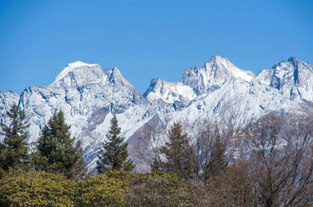
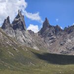
Mt. Aotaiji is 5257 meters above sea level, the highest mountain in Heishui County. Aotaiji means “father of all mountains” in local belief. Mt. Aotaimei is 5257 meters and it is a granite mountain with many towers. Aotaina is called “son of mountains”, a 4800-m not so high mountain that has a name due to its cultural significance. All three mountains have no glaciers developed.
These three mountains are often known as “San-Ao” snow mountains within China. It is one of the popular places for outdoor activities. Above 4000 meters the temperature is low to -10C and the rest of time temperature can be low to 0C. “San-Ao” are holy mountains among local people.
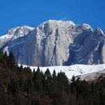
Mt. Zimei is 5210 meters and it is the border mountain of Lixian County and Heishui County. The top has two peaks that are 5210 meters by the east and 5100 meters by the west. First recorded cliimb was a Chinese team in 2016.
Mt. Xuejian is another mountain in the famous Mengdun Valley. It is 5203 meters above sea level. 32km from Shangmeng Village and located by the end of Baiyanggou Valley, this mountain has been explored in 2008 but no record of climb.
The 5083-m Mt. Shenfeng is located north to Gu’ergou Zhen, the famous hot spring take its name from this mountain. South east to Mt. Shengfeng are 5064-m Mt. Jiutouyan and 5000-m Rooster Rock. Between these two mountains there are penty of small towers.
Climate and Climbing Season
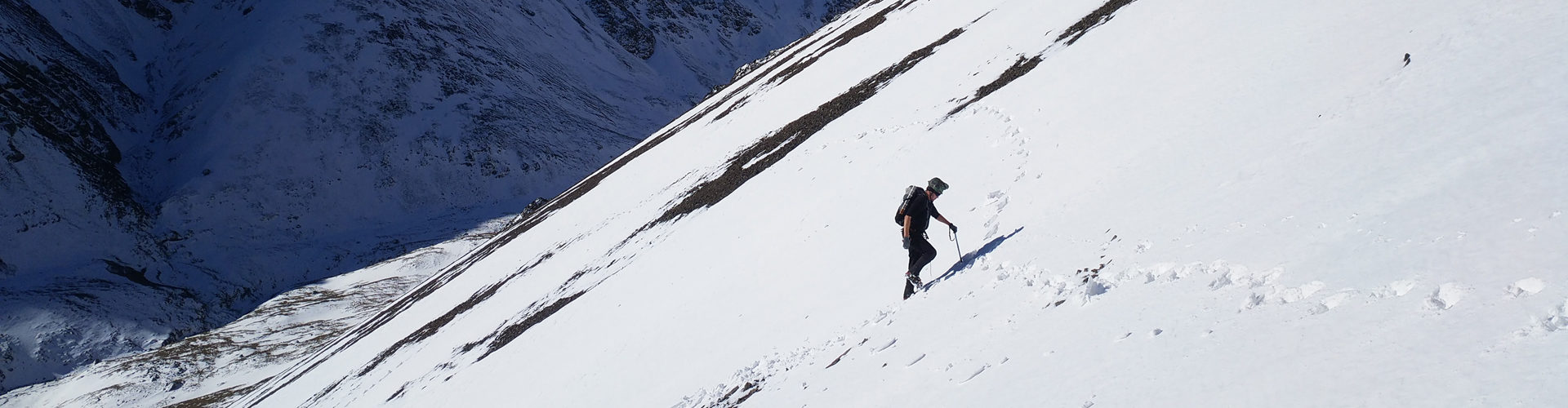
This part of Qionglaishan Range is located on the eastern edge of the Qinghai-Tibet Plateau. Mountainous regions have many climate zones and weather is unstable. Former climbs are done from May to November. Some people to climbs in the summer here.