Introduction
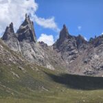
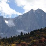
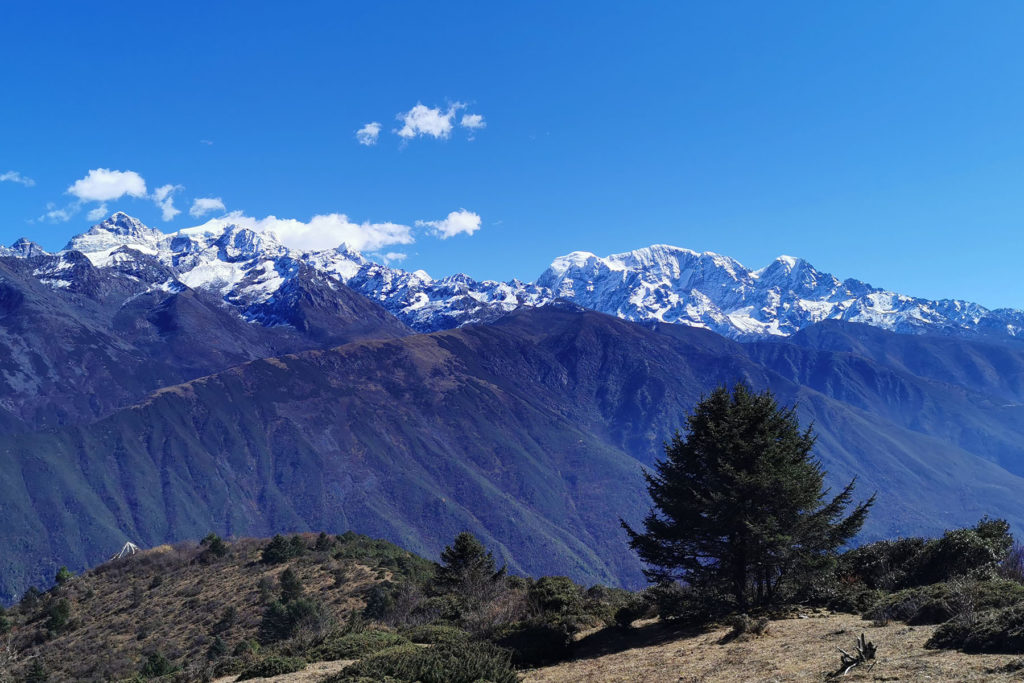
Lamoshe is also called Wuse Mountain Massif. It is the cluster of mountains located east to the city of Kangding. Lamoshe is acctually part of Minya Konka Range by its northeast, seperated by Xuemenkan Road Pass. There are around 10 prominent peaks that are over 5500 meters located by this massif. All these mountains stand together from north to south.
Location
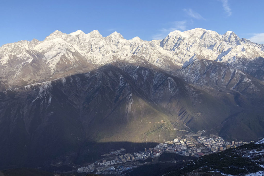
At its east is the river gorge of Dadu, and at its west is the town of Kangding. South to the massif is the main part of Minya Konka Range. The massif is directly 200km from Chengdu. From Chengdu drive to the east of the mountains at Luding Town takes around 4 hours and it takes also 4 hours driving from Chengdu to Kangding at its west side.
Mountains
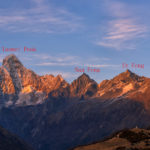
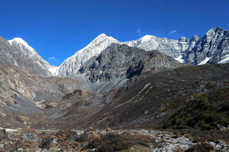
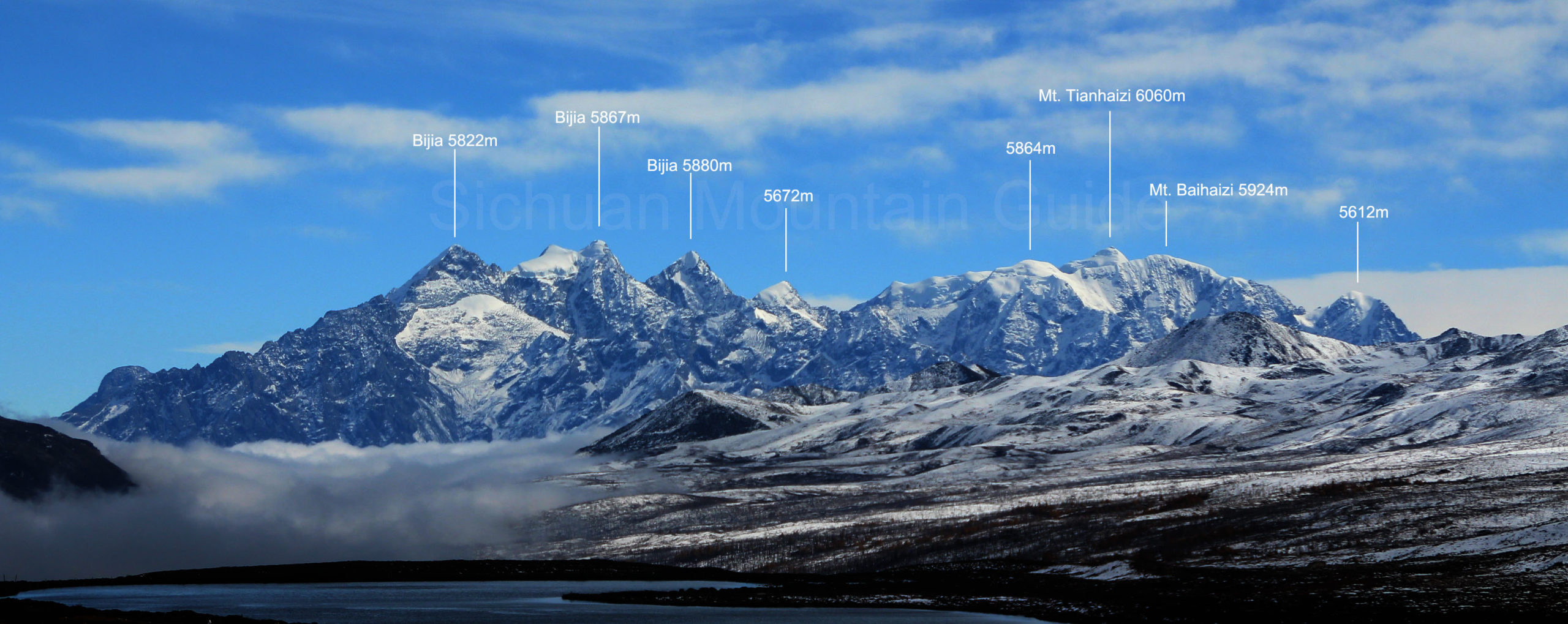
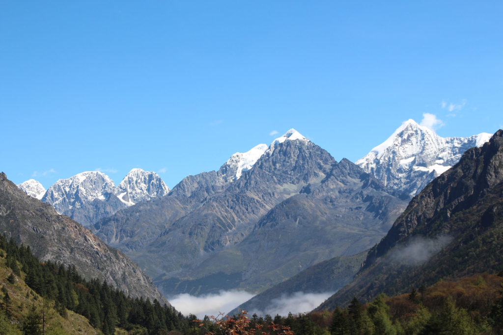
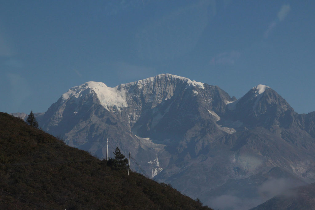
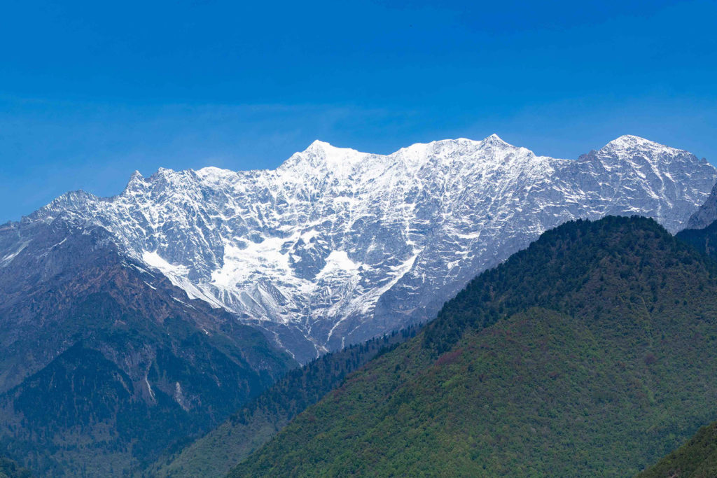
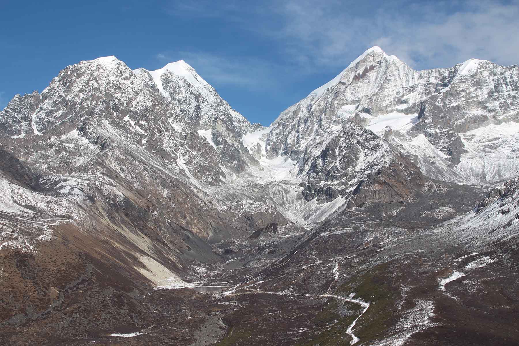
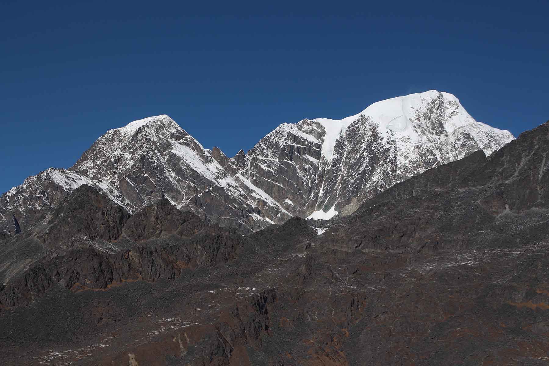
This massif goes from north to south are the mountains of Bijia, Shehaizi, Baihaizi, Tianhaizi. Among them Tianhaizi is the highest peak at an elevation of 6070 meters.
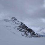
Mt. Shehaizi is 5878 meters above sea level.
Shehaizi South Peak is 5672 meters above sea level. The 5672-meter Shehaizi South Peak is easy to enter. There is a gourd-shaped valley surrounded by mountains on three sides, with rock lines on both sides. Three icefalls hang at the end of the valley. The shortest approach will need to cross an 80-meter ice-climb, that involves multiple sections of ice climbing. Not far above the ice waterfall is the platform where the Shehaizi and Baihaizi Glaciers are stacked. Above the platform is a huge fan-shaped glacier (ice snow basin). There are many obvious cracks that need to pass through. The difficulty above the ice field is how to approach the col between Shehaizi and Shehaizi South Peak but may involve danger of falling rocks. Risk of avalanches for approaches from both sides.
In January 2007, a Chinese team tried to climb, but did not reach the summit.
Another Chinese team summited this peak in July 2010 and recorded this mountain to be 5662 meters. It took them total 4 days. They started from Laoyulin and approached from the west side.
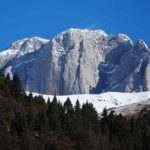
Mt. Beihaizi is 5924 meters.
Mt. Beihaizi is the second highest mountain in this massif. Its top is at the elevation of 5924m. Its coordination is E102.061400, N29.957240. There is no recorded climbs of this mountain. There are two other mountains close to this peak: Baihaizi North Peak at 5864 meters and Beihaizi South Peak at 5612 meters.
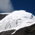
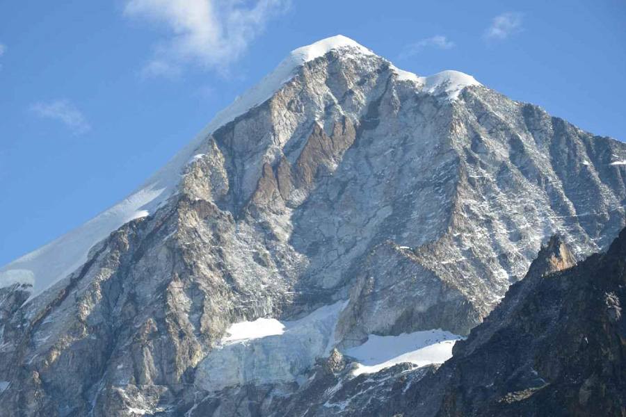
Mt. Tianhaizi is at the elevation of 6070m. Its coordination is N102.050670, E29.949431. Baihaizi is the highes peak of Lamoshe, sometimes the name Lamoshe refers to the highest peak of Tianhaizi. Mt. Tianhaizi is named Wuse Mountain or Hunhaizi Mountain. Mt. Tianhaizi has 3 full ridges and it has walls on its east, west and north sides. The elevation drop on north and east sides are huge. The usual approach is from west of Mt. Tianhaizi.
Climate and Climbing Season
The area has a temperate plateau climate, and the climate changes greatly. The rainy season is from June to October each year, and the dry season is from November to May the following year. The annual rainfall is 800-900 mm, mostly in July, August, and September. In summer, the amount of cloud is large, and the daily temperature difference is also large. Sometimes the temperature can reach -20 ℃ above 6000 meters above sea level. The weather in the dry season is sunny and milder than in other areas of the same latitude. Most former mountaineering trips are conducted between dry and rainy seasons.
Climbing season: April to May and October to December
Approaching
West
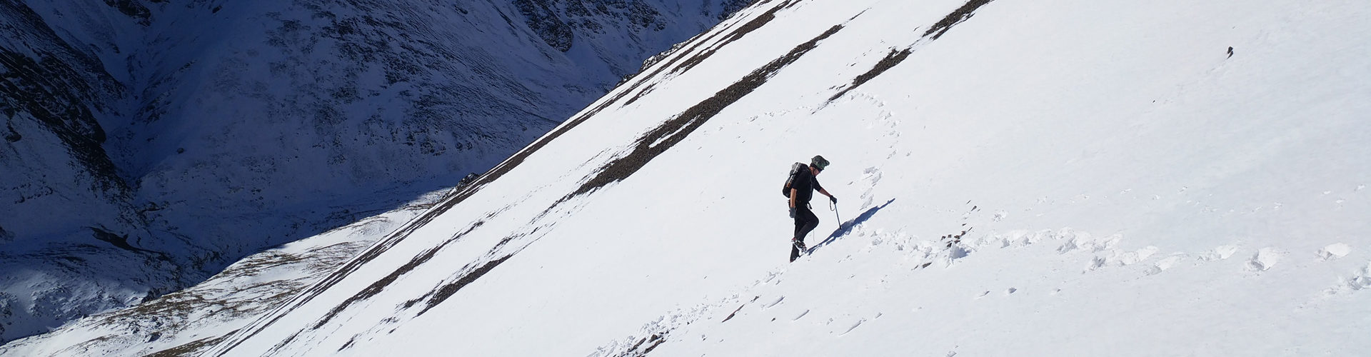
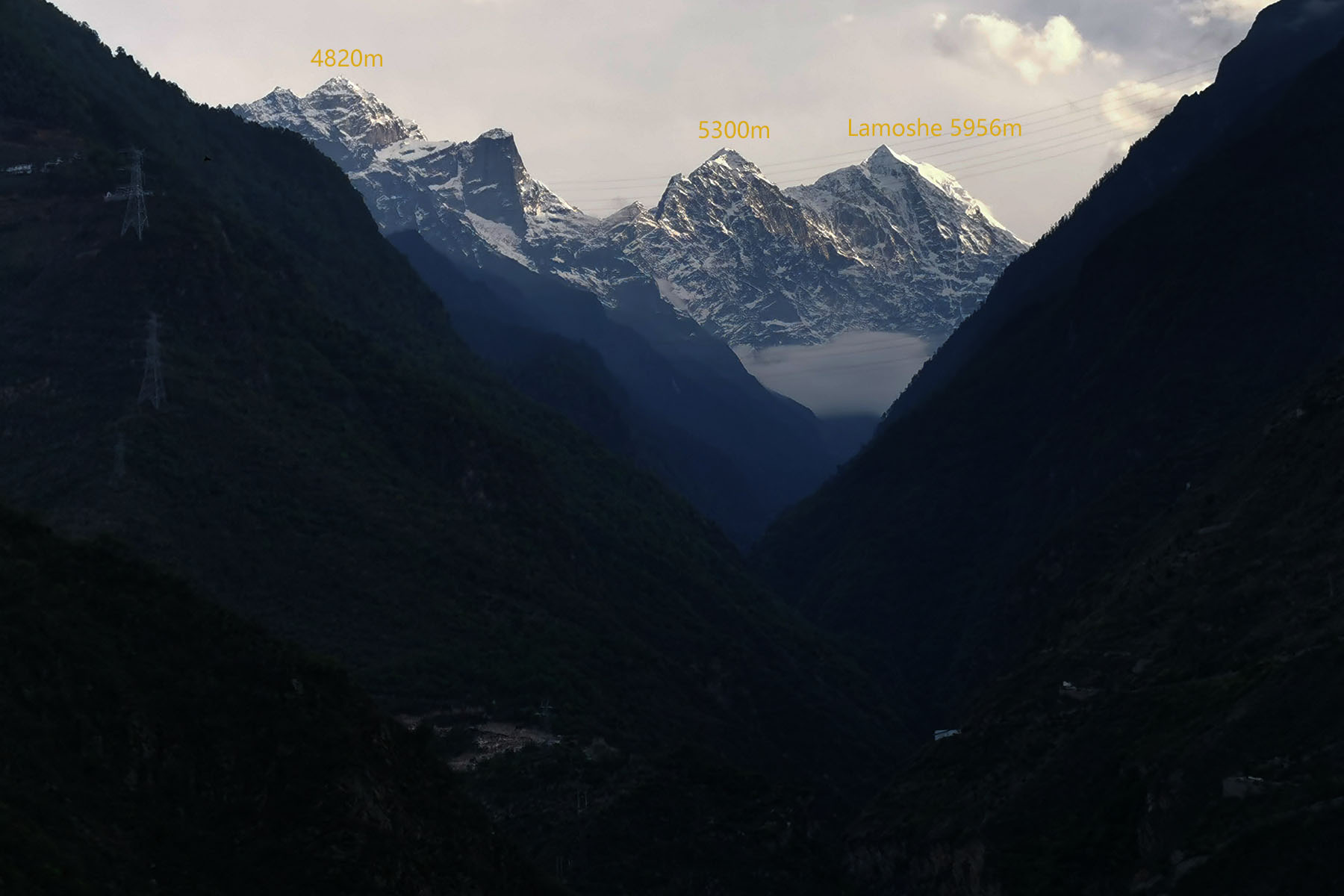
The usual approach is from its west.The mountains that are climbed more than once is Mt. Tianhaizi accessed from its south by Xuemenkan and climbed by its west ridge starting from the col at 5300 meters. Mt. Shehaizi and Mt. Baihai and their surounding mountains can be accessed from both its west and east sides. From its west side you can go to the west base directly from the city of Kangding, making this mountains very easy to access. The paralleled valleys west to the mountains all start from the city of Kangding and lead to the west base of Lamoshe mountains. All valleys are around 8-10km approach on foot from Kangding road end and you reach from 2600 meters to above 4000 meters.
East
The east side of the mountains are less explored and the recent successful summit was made in May 2019 by an Itanlian team from Luding to Mt. Tianhaizi by its east wall. From east one can use Luding town as a stopover place and it is another 30 minutes drive to the villages down the valleys. And from the villages it is 8-10km approach by foot to around 4000 meters. Weather is usually more unpredictable on the east side. Though a massif of mountains next to towns of over 10,000 people, north, east and northeast valleys still stay basically unexplored.
Essential Locations
Kangding is a town west to Lamoshe Massif.
Luding is a town located east to Lamoshe Massif.
Laoyulin is the village south to the town of Kangding and the stopover place to the west, south of Lamoshe.
Climbing History
An American team and Korean team reached the 6070M Mt. Tianhaizi in 1994 and 2002 respectively.
An American team made summit of Mt. Tianhaizi in 1993.
A Japanese climbing team climbed Mt. Tianhaiz in 2000.
An American-Canaddian-New Zealand United team reached the summit of Mt. Shehaizi 5878M.
The South Korean climbing team reached the top of Mt. Tianhaizi in 2002.
In May and September 2004, two Chinese teams made summit to Mt. Tianhaizi.